
Navigation
The very earliest sailors navigated close to shore using their knowledge of coastal landmarks and natural phenomena.
"In 400 metres turn right…"
These days, when driving from A to B, we have our choice of help with navigation. From maps – usually via our phones – to the good old-fashioned method of asking for directions (depending on who’s driving!) and of course, Sat Nav.
From a maritime perspective, navigation is a much more structured and collaborative process which involves planning, recording and controlling the movement of vessels from one place to another. Lighthouse Authorities around the world are responsible for ensuring the Aids to Navigation (AtoN) infrastructure and services in their waters.
If you consider that trade by sea is growing and that approximately 95% of all logistics are carried out by sea, the need for rigorous and coordinated AtoN services can be better understood.
Blackhead, Co. Antrim
Maritime Navigation Begins
The very earliest sailors navigated close to shore using their knowledge of coastal landmarks and natural phenomena (birds, clouds, tides, floating debris) to guide them. The celestial bodies – the sun by day and the stars by night – also helped guide mariners, and still do today.
The first AtoN was developed, it is estimated, in 280BC when a lighthouse was built to mark the entry to the port of Alexandria in Egypt. This impressive lighthouse was even one of the seven wonders of the ancient world.
By Christopher Columbus’ era, ocean navigation was well underway. We were already navigating our way with magnetic compasses and types of quadrants. The first navigational charts had also appeared. The process of ‘dead reckoning’, where the position of a ship is established and subsequent positions are calculated based on a measured course and speed, was also in use. The speed of a vessel was calculated by throwing a log overboard on a rope with knots tied at known intervals and measuring how many knots played out over a set time interval. This is the origin of the present day term “knots”, which is used to describe the speed of a ship or a current in a body of water.
Later sextants and chronometers were invented and were used to accurately calculate a ship’s latitude and longitude based on observations of the sun and stars. Detailed navigational charts covering the known world also became available to guide mariners. The use of lighthouses was becoming more common, and the first floating AtoN to include a burning light was the Lightship Nore, established at the mouth of the River Thames in London in 1731.
National Authorities Established
Today with modern transatlantic air travel, it’s easy to forget that at that time – 200 years ago – all international commerce and communication was by sea. This explains the vital importance of these AtoNs in facilitating safe sea travel as it was so critical that national AtoN providers were established. The Commissioners of Irish Lights (then the Corporation for Preserving and Improving the Port of Dublin) was set up in 1786 as the National AtoN provider for the island of Ireland.
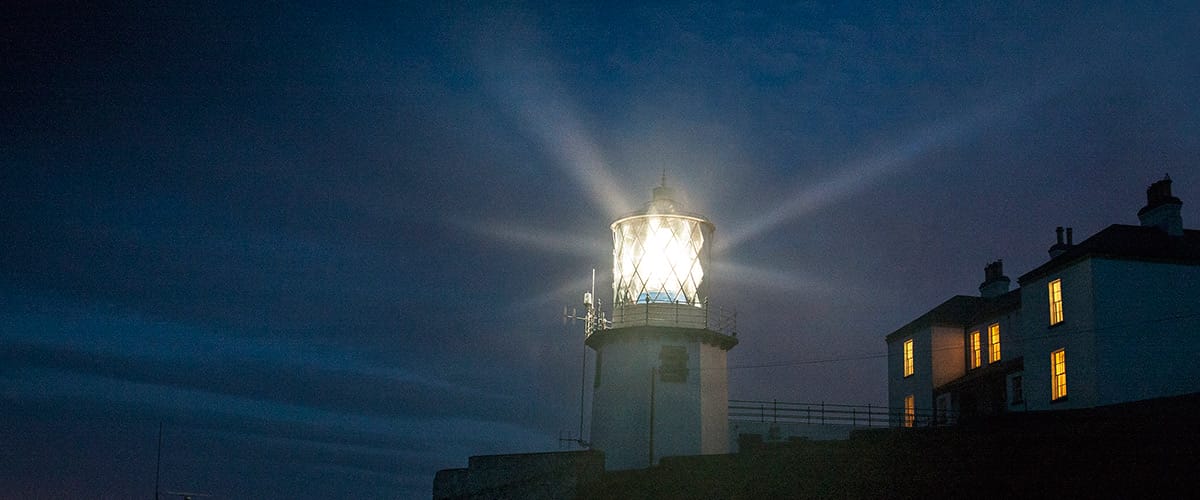
In the 1900s, radio technology was in its infancy, and the nature of AtoNs had not changed dramatically for many years. A visual system of lighthouse ‘daymarks’ (conspicuously painted with distinctive colours, like eye-catching Hook Head Lighthouse and St John’s Point) and lightships by day, and a system of uniquely-timed flashing lights by night, coupled with an audible system of fog signals, were provided for mariners at manned lighthouses and lightships. Though there are no longer lighthouse keepers at these stations, these aids are still provided, and are now sometimes known as traditional AtoNs.

St John's Point, Co. Down
Technological Advances
Over the course of the last century and to the present day, huge advances have been made in terms of terrestrial and extraterrestrial communication – particularly in the fields of radio and satellite navigation respectively. The more notable terrestrial-based systems have been radio beacons, Radio Detection and Ranging (Radar), Decca, and Loran. Of the extraterrestrial Global Navigational Satellite Systems (GNSS), GPS is the most well-known.
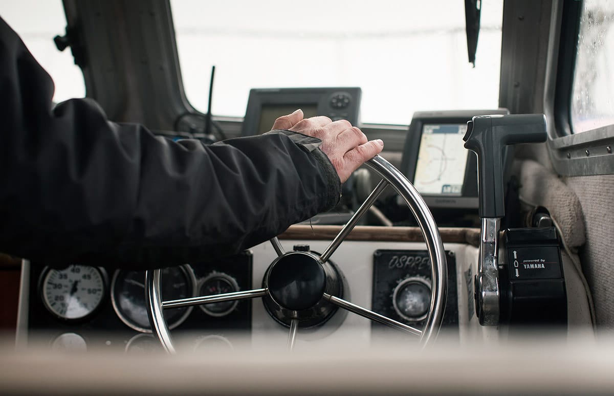
Today, ships have a wealth of systems with which to determine their position, course, and speed relative to hazards and other vessels. A large ship uses a combination of what is known as ‘Heads Up’ – when the ship is guided by a captain viewing the visual surroundings directly, and ‘Heads Down’ navigation, when a ship is guided by reference to an electronic sensor display.
Though new technologies have emerged, navigating by eye using visual AtoNs still plays a huge role in marine safety. Not all those who use our seas are equipped with satellite navigation systems and the latest technology. And, of course, one of the key principles in AtoN provision is that there must be alternatives available in the case of failure of any system. A mix of systems is critical to ensuring safe navigation.
A ship equipped with modern electronic navigation systems, good visual information on her surroundings and an alert and responsible captain, is as good as you’ll get in navigational terms, and ensures optimum safety at sea.